Floods are one of the most common and devastating natural disasters in India. They occur when water overflows onto land that is usually dry, submerging homes, roads, and fields. India, with its diverse geography and monsoon-dependent climate, faces frequent floods, especially during the rainy season from June to September. These floods cause immense loss to life, property, agriculture, and infrastructure.
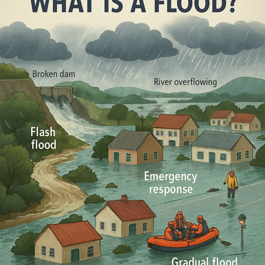
Table of Contents
What is a Flood?
A flood is an overflow of water that submerges land that is usually dry. It can happen due to heavy rainfall, river overflow, dam failure, or even a sudden release of water. Floods can develop slowly over days or occur suddenly as flash floods.
Major Causes of Floods in India
- Heavy Monsoon Rainfall: Most floods in India are caused by intense rainfall during the monsoon season.
- River Overflow: Major rivers like the Ganga, Brahmaputra, and Yamuna often flood when they receive excess water.
- Dam Failure or Release: Sudden release from dams can flood downstream areas.
- Poor Drainage System: Urban flooding in cities like Mumbai and Delhi is due to clogged drains and unplanned development.
- Deforestation: Reduces soil absorption and increases runoff.
- Glacial Lake Outburst Flood (GLOF): Melting glaciers in the Himalayas can suddenly release water.
Flood-Prone Areas in India
India has several flood-prone regions, especially:
- Assam and Bihar – Annual floods due to Brahmaputra and Ganga rivers.
- Uttar Pradesh and West Bengal – Ganga plains frequently flood.
- Odisha and Andhra Pradesh – Cyclonic rains and river floods.
- Maharashtra, Kerala, and Tamil Nadu – Urban and flash floods during intense rains.
- Uttarakhand and Himachal Pradesh – Flash floods due to cloudbursts and GLOFs.
Major Floods in India (Recent Examples)
| Year | Location | Impact |
|---|---|---|
| 2023 | Assam | Over 50 deaths, 30+ lakh people affected |
| 2018 | Kerala | Worst flood in a century, 400+ deaths, huge economic loss |
| 2013 | Uttarakhand (Kedarnath) | Flash flood due to cloudburst and glacial burst, 5,000+ deaths |
| 2008 | Bihar (Kosi River) | Over 500 deaths, 30 lakh affected |
Effects of Floods
- Loss of human life and livestock
- Damage to property and infrastructure
- Disruption of transportation and communication
- Crop destruction and food shortages
- Waterborne diseases like cholera and dysentery
- Migration and displacement of people
Flood Management and Mitigation in India
- Embankments and Dams: Built to control river flow.
- Flood Forecasting and Warning: IMD and CWC issue alerts.
- Improved Drainage Systems: Especially in urban areas.
- Afforestation: Trees help absorb rainwater and prevent runoff.
- Zoning Laws: Avoiding construction in floodplains.
- Disaster Response Teams: NDRF (National Disaster Response Force) helps in rescue and relief.
Government Initiatives
- National Disaster Management Authority (NDMA): Plans and coordinates disaster response.
- Flood Management Programme (FMP): Assists states in flood control projects.
- Real-Time Flood Monitoring: Central Water Commission (CWC) uses satellite and weather data.
Conclusion
Floods are a recurring challenge for India, but their impact can be reduced through scientific planning, better infrastructure, early warning systems, and public awareness. With climate change increasing the intensity of rains and melting glaciers, the risk of floods is rising. A coordinated effort between the government and citizens is essential for building a flood-resilient India.
Read: Geography Notes