The Laws of International Boundaries and Frontiers are a set of legal principles that define and regulate the borders between countries. This is essential to establish and maintain the territorial integrity, sovereignty, and security of nations. It ensures peaceful relations and cooperation between neighboring countries.
Table of Contents
What are International Boundaries and Frontiers?
International boundaries refer to the lines that demarcate the geographical and political boundaries between different countries. These boundaries can be natural, such as rivers or mountain ranges, or man-made, such as walls or fences. Whereas, The frontier between countries refers to the buffer area between two countries located nearby.
"One example of an international frontier is the border between the United States and Canada. "
Case Study: McMohan Line
The McMahon Line is a demarcation line that acts as the boundary between India and China. It was proposed by British colonial administrator Sir Henry McMahon during the Shimla Convention negotiations held in 1914 between British India, Tibet, and China. The convention aimed to address territorial disputes and define the boundaries between British India, Tibet, and China.

International boundaries and frontiers are fundamental elements of political geography, defining the spatial limits of sovereign states. These boundaries demarcate jurisdiction, control, and influence, and their regulation is essential for maintaining international peace, security, and cooperation. The laws governing international boundaries and frontiers encompass a complex framework of treaties, customary international law, judicial decisions, and diplomatic practices.
International Law
The United Nations Charter, Vienna Convention on the Law of Treaties (1969), and various regional agreements provide the legal basis for boundary creation and enforcement. Key principles include:
-
Sovereign Equality of States: Each state has the right to define and protect its territory.
-
Territorial Integrity: No state should threaten the territorial boundaries of another.
-
Peaceful Settlement of Disputes: All boundary disputes should be resolved through dialogue, arbitration, or adjudication.
Customary Practices and Treaties
-
Bilateral and Multilateral Treaties: Define and codify boundary agreements (e.g., Treaty of Tordesillas, 1494).
-
Historical Usage: Long-standing practices often play a role in determining borders.
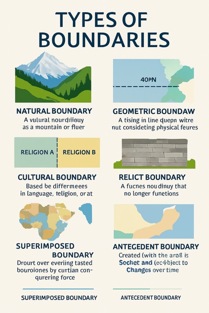
Types of Boundaries
International boundaries can be categorized based on their physical and administrative characteristics:
-
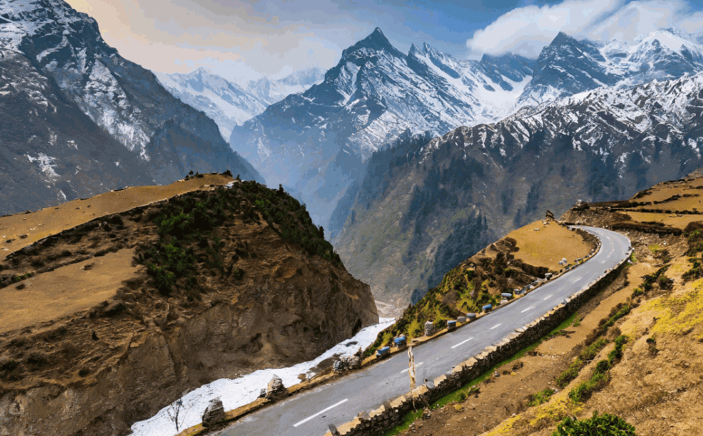
Natural Boundaries: Rivers, mountains, deserts (e.g., Himalayas between India and China).
-
Geometric Boundaries: Based on latitude and longitude (e.g., US–Canada border along the 49th parallel).
-
Relict Boundaries: No longer functional but still visible (e.g., Berlin Wall remnants).
-
Political Boundaries: Established through diplomatic negotiation or conflict resolution.
Boundary Demarcation and Delimitation
-
Delimitation: The legal process of describing boundaries in treaties or maps.
-
Demarcation: The physical marking of boundaries on the ground using fences, posts, or walls.
-
Maintenance: Ongoing monitoring to prevent encroachments and resolve cross-border issues.
Disputes and Conflict Resolution
Boundary disputes can arise due to ambiguous treaties, colonial legacies, or resource competition. Common methods of resolution include:
-
Negotiation and Mediation
-
International Arbitration (e.g., Permanent Court of Arbitration)
-
Judicial Settlement (e.g., International Court of Justice decisions on the Bakassi Peninsula)
Special Cases and Zones
-
Maritime Boundaries: Governed by the United Nations Convention on the Law of the Sea (UNCLOS).
-
Air and Space Boundaries: Less defined, often governed by international aviation treaties.
-
Disputed Territories: Areas claimed by multiple states (e.g., Kashmir, Western Sahara).
Recent Trends and Challenges
-
Climate Change: Rising sea levels affecting maritime boundaries.
-
Geopolitical Conflicts: Expansionist policies or secessionist movements challenging established borders.
-
Technological Advancements: Use of satellite imagery and GIS in boundary demarcation.
Frontier
A frontier is a geographical zone or area located at the edge of a country, often separating it from another country or unclaimed land. Unlike a fixed and clearly defined boundary, a frontier is usually broad, less precise, and more fluid. It represents a zone of transition and interaction between different political, cultural, or geographical regions.
Key Features of a Frontier
-
Undefined or Weakly Defined
-
A frontier is not marked by exact legal or political lines like international boundaries. It may stretch across several kilometers and lacks strict demarcation.
-
-
Zone of Transition
-
Frontiers often act as transitional spaces between different countries, cultures, or civilizations. They can be areas of both conflict and cultural exchange.
-
-
Dynamic in Nature
-
Frontiers can shift over time due to military conquest, colonization, migration, or political agreements.
-
-
Low State Control
-
These regions may have weak governmental presence or law enforcement, often leading to smuggling, migration, or disputes.
-
Types of Frontiers
-
Political Frontier: Area where control between two or more countries is contested (e.g., Kashmir).
-
Cultural Frontier: Region between two distinct cultural or ethnic groups.
-
Geographical Frontier: Physical terrain acting as a barrier (e.g., deserts, mountain ranges).
-
Historical Frontier: Used during periods of exploration or colonization, such as the American frontier in the 19th century.
Examples
-
Afghanistan–Pakistan Border: The Durand Line area is often called a frontier due to limited control and tribal settlements.
-
Western Frontier of India: The area bordering Pakistan, especially in Rajasthan and Gujarat, has historically been described as a frontier zone.