Awareness in space refers to the ability of individuals to understand and manage the risks associated with space activities, as well as to maintain situational awareness of their surroundings in space.
One of the key challenges of space awareness is the vastness and complexity of space itself. Space is a dynamic environment that is constantly changing, and it is home to a wide range of hazards, from space debris and solar flares to radiation and extreme temperatures. To navigate these challenges, organizations involved in space activities must invest in advanced technology and develop robust risk management strategies.
Table of Contents
Dimensions to Space Awareness
-
Launch Vehicles: These are the vehicles used to transport spacecraft and payloads into space. Launch vehicles come in a variety of designs and sizes, from small sounding rockets to large expendable rockets.
-
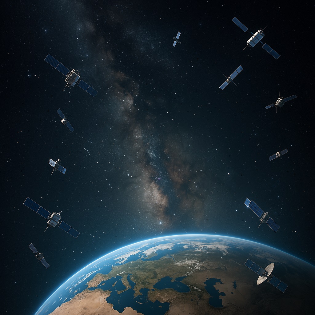
Satellites: These are spacecraft that are placed into orbit around the Earth or other celestial bodies. Satellites are used for a wide range of purposes, including communication, navigation, meteorology, remote sensing, and scientific research.
-
Spacecraft: These are vehicles designed for space travel and exploration. Spacecraft come in a variety of designs, including capsules, rovers, landers, and orbiters.
-
Space Suits: These are specialized suits designed to protect astronauts in the harsh environment of space. Space suits provide life support, temperature regulation, and protection against radiation and micrometeoroids.
-
Space Probes: These are spacecraft designed for exploration and study of celestial bodies. Space probes can be sent to study planets, moons, asteroids, and comets.
-
Space Debris: This refers to the collection of man-made objects in space that are no longer functional, including old satellites, rocket stages, and debris from space missions.
-
Space Stations: These are artificial structures placed in orbit around the Earth, designed to support human life and provide a platform for scientific research and technological development.
-
Remote Sensing: This refers to the collection of data from a distance, such as from a satellite or an aerial platform. Remote sensing is used for a wide range of purposes, including environmental monitoring, natural resource management, and intelligence gathering.
-
Space Navigation: This refers to the techniques and systems used for navigation in space, including onboard navigation systems, ground-based navigation systems, and satellite-based navigation systems.
-
Space Communication: This refers to the communication systems and technologies used for communication between spacecraft, between spacecraft and ground stations, and between ground stations.
Launch Vehicles
These are the vehicles used to transport spacecraft and payloads into space. Launch vehicles come in a variety of designs and sizes, from small sounding rockets to large expendable rockets. In Indian context, we have two space launch vehicles:
- PSLV
- GSLV
Why Are Launch Vehicles Important?
-
Enable India to send satellites into orbit for weather, communication, education, and navigation.
-
Reduce dependence on foreign space agencies.
-
Strengthen national security and disaster management systems.
-
Contribute to global space missions and commercial satellite launches.
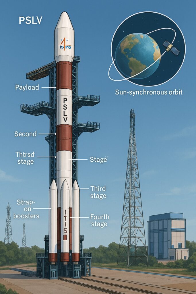
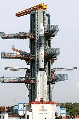
PSLV (Polar Satellite Launch Vehicle)
The Polar Satellite Launch Vehicle (PSLV) is a medium range launch vehicle designed and operated by the Indian Space Research Organisation (ISRO). It was developed to allow India to launch its Indian Remote Sensing Satellites into sun synchronous orbits. It works on four stages using both Solid and Liquid Fuels.
"The PSLV has launched satellites for over 35 countries, making India a trusted name in global space services."
India’s first lunar probe Chandrayaan-1, India’s first interplanetary mission was launched using PSLV. Mars Orbiter Mission (Mangalyaan) was also launched using PSLV.
One of the most successful mission using PSLV the launch of PSLV-C37 on 15 February 2017, successfully deploying 104 satellites into sun-synchronous orbit. It has both solid stage and liquid stages.
GSLV: The GSLV is a three stage/engine rocket. The core of first stage is fired with solid fuel, the second stage is the liquid fuel-propelled and the third is the cryogenic engine.
GSLV Mk III is a three-stage heavy lift launch vehicle developed by ISRO. GSLV Mk III is designed to carry 4-ton class of satellites into Geosynchronous Transfer Orbit (GTO) or about 10 tons to Low Earth Orbit (LEO), which is about twice the capability of GSLV Mk II.
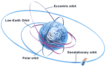
Types of Orbit : Awareness in Space
- Geostationary Orbit
- Geosynchronous Orbit
- Polar Orbit
Geostationary Orbit
TV transmission satellite is kept in a geostationary orbit. Geostationary orbits can only be accomplished with equatorial orbits, and since India is in the northern hemisphere this means the satellite will always be in south direction.
Geostationary satellite is a kind of geo synchronous satellite. It takes 24 hours or one day to cover the earth. A geostationary satellite travels from west to east over the equator. It moves in the same direction and at the same rate Earth is spinning.
From Earth, a geostationary satellite looks like it is standing still since it is always above the same location. The orbit is circular. The height is in 35,786 Km (roughly 36 thousand Km).
Geosynchronous Orbit
A geosynchronous orbit is a high Earth orbit that allows satellites to match Earth’s rotation. Located at (35,786 kilometers) above Earth’s equator, this position is a valuable spot for monitoring weather, communications and surveillance.
“Because the satellite orbits at the same speed that the Earth is turning, the satellite seems to stay in place over a single longitude, though it may drift north to south,”
Polar Orbit
Satellites placed in polar orbits have an inclination of about 90 degrees to the equator and travels north south over the poles at lower altitudes.
A satellite in the polar orbit approx. takes 90 minutes for a full rotation. As a result, a satellite can observe the entire surface in the time span of 24 hours.
Polar-orbiting satellites travel in a north-south direction from pole to pole. As Earth spins underneath, these satellites can scan the entire globe, one strip at a time.
Indian Data Relay Satellite System
It will facilitate relay of information between various Indian spacecraft, in-flight launch vehicle monitoring and assist Indian Human Spaceflight Programme.
A Data Relay Satellite System (DRSS) facilitates continuous real-time communication between Low Earth orbit bound spacecraft to the ground station as well as inter-satellite communication. Such a satellite in geostationary orbit can track a low altitude spacecraft up to almost half of its orbit.
Conclusion: Awareness in Space
To promote awareness in space, organizations and governments around the world are investing in space situational awareness (SSA) systems. These systems use advanced sensors and data analysis techniques to monitor and track objects in space, such as satellites and space debris, and to predict potential collisions or other hazards.
Ultimately, awareness in space is crucial for the continued success and safety of space activities. By investing in advanced technology, robust risk management strategies, and effective communication and collaboration, we can continue to explore and utilize space in a responsible and sustainable way.