The Polar Front Theory is also known as the Polar Front Theory of Cyclones, is a meteorological concept that explains the formation and development of mid-latitude cyclones. It was developed in the early 20th century by Norwegian meteorologist Vilhelm Bjerknes and his colleagues, and it revolutionized the understanding of weather systems.
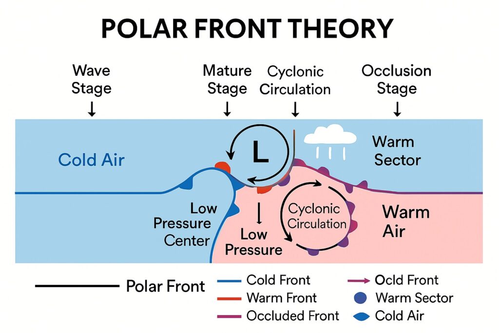
Table of Contents
Origin of the Theory
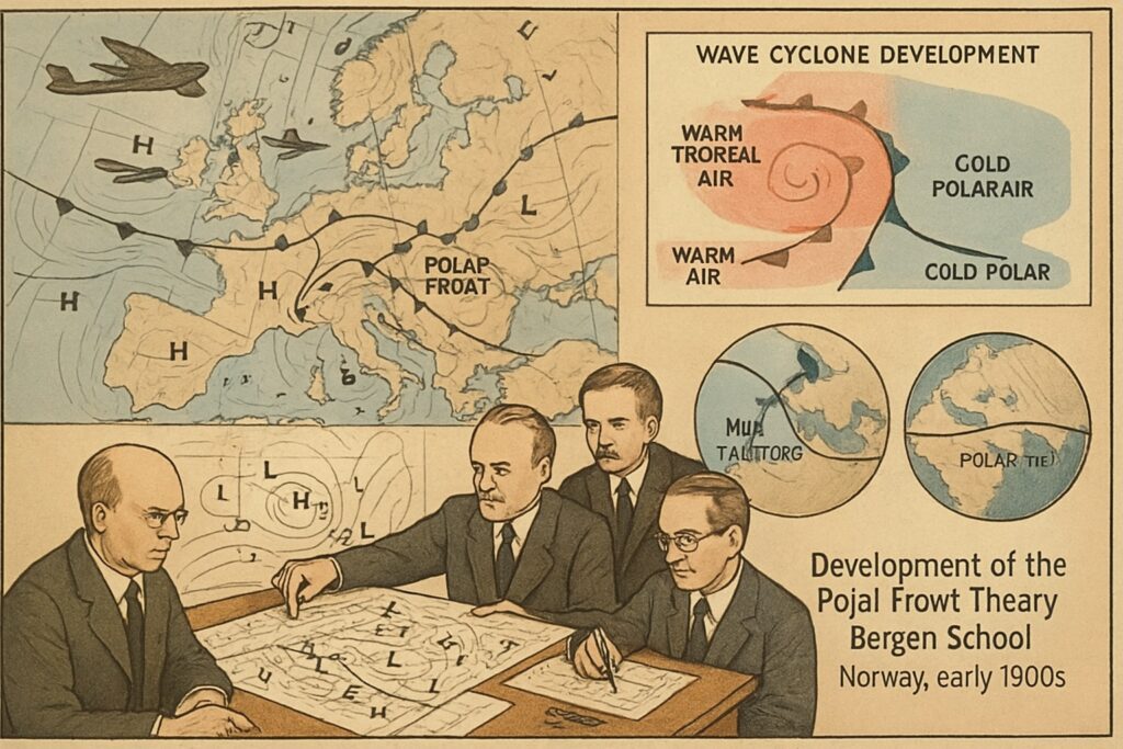
The Polar Front Theory was developed in the early 20th century by meteorologists at the Bergen School of Meteorology in Norway, under the leadership of Vilhelm Bjerknes and his colleagues, including Jacob Bjerknes, during and after World War I.
During the war, increased meteorological observations across Europe and the North Atlantic—primarily for military aviation and naval operations—provided a rich dataset of weather patterns. These observations helped scientists identify the interactions between different air masses, especially in mid-latitudes.
The Bergen School proposed that extratropical (mid-latitude) cyclones form along the polar front, a boundary where cold polar air meets warm tropical air. The theory described how this boundary becomes unstable, leading to the formation of a wave that eventually develops into a cyclone with distinct warm and cold fronts.
The Polar Front Theory revolutionized weather forecasting by providing a systematic and dynamic model for the structure, development, and life cycle of cyclones, laying the foundation for modern synoptic meteorology.
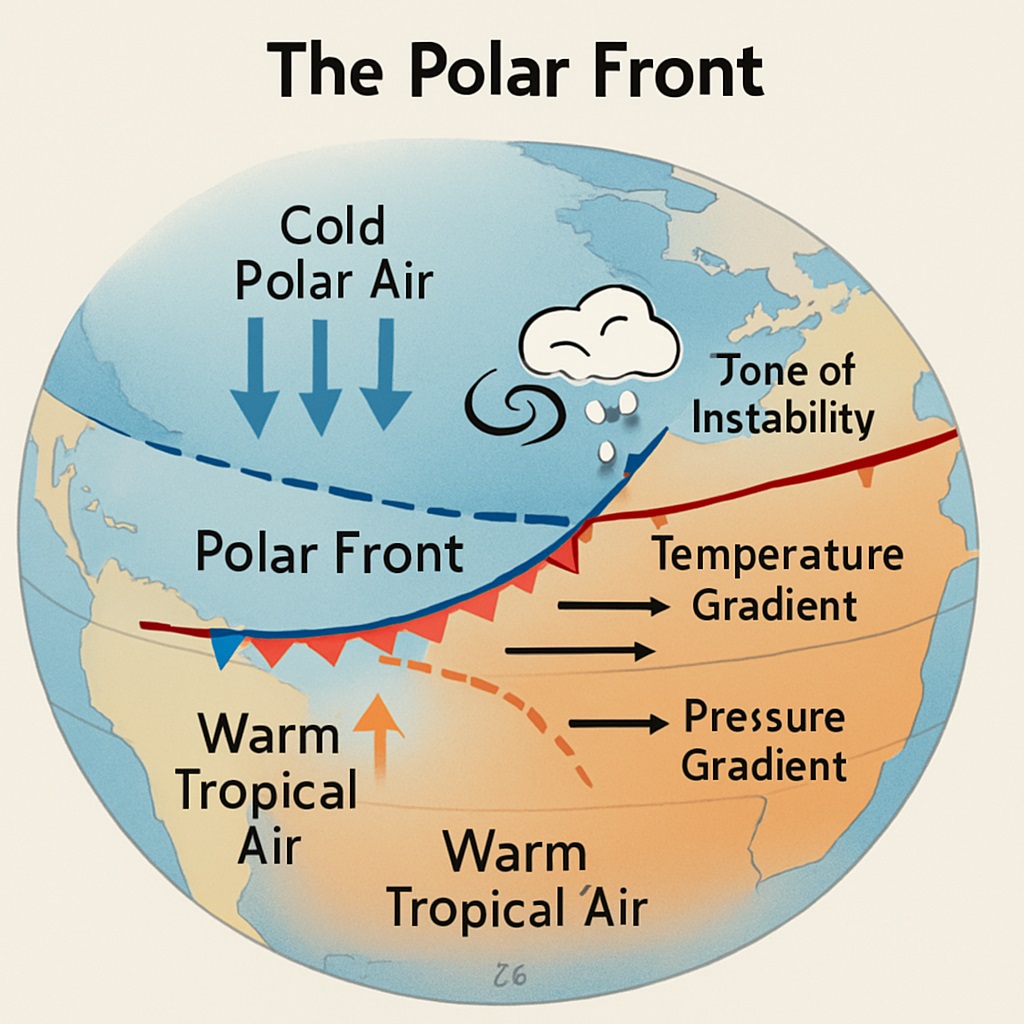
The theory revolves around the idea of a dynamic boundary known as the polar front. The polar front is a region where the warm air masses from the tropics meet the cold air masses from the polar regions. This boundary separates the colder polar air from the warmer air to the south, creating a sharp temperature contrast and a zone of active atmospheric processes.
What is the Polar Front?
The polar front is the boundary between two contrasting air masses:
-
Cold polar air from high latitudes.
-
Warm tropical air from lower latitudes.
This front is a semi-permanent, quasi-stationary feature typically found between 35° and 65° latitudes in both hemispheres. The sharp temperature and pressure gradient at the polar front creates an area of instability, which is crucial for the development of cyclonic storms.
Key elements and concepts of the Polar Front Theory
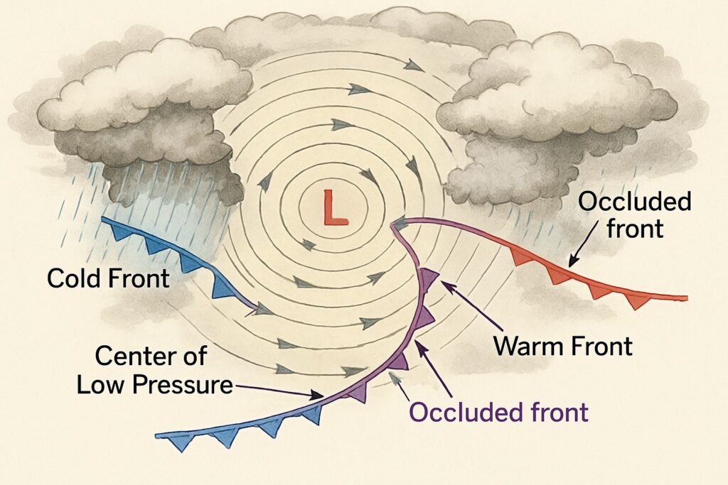
Cyclogenesis
-
-
Cyclones begin as a small disturbance along the polar front.
-
A wave-like pattern forms, leading to the development of a low-pressure center.
-
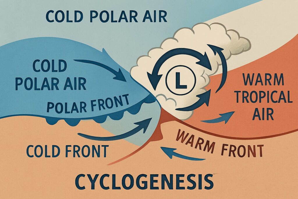
Frontal Development
-
-
The warm air moves poleward and upward over the cold air (forming a warm front).
-
Cold air moves equatorward beneath the warm air (forming a cold front).
-
This results in a frontal system with distinct warm and cold sectors.
-

Mature Stage
-
-
The cyclone deepens, and the pressure at the center drops.
-
Precipitation and strong winds are common along the fronts.
-
The occluded front eventually forms as the cold front catches up with the warm front, lifting the warm air entirely off the ground.
-
Dissipation
-
-
Once the warm air is fully displaced aloft, the energy source (temperature gradient) weakens.
-
The system gradually dissipates.
-
The Polar Front Theory provided a comprehensive framework for understanding the complex dynamics of mid-latitude cyclones. It contributed to advancements in weather forecasting and the study of atmospheric processes, significantly improving our understanding of the structure and behavior of weather systems in the mid-latitudes.
Read: Geography Notes